Biesbosch National Park Trail
Biesbosch National Park Trail: Freshwater Tidal Wetland Loop
HikeList Score
Biesbosch National Park Trail scored 74/100 on HikeList's trail-quality metrics.
See score breakdownHide breakdown
- Ideal length 55
- Balanced challenge 90
- Scenery & wildness 58
- Varied terrain 100
- Accommodation 66
- Food & support 88
- Path quality 81
- Season flexibility 89
Computed from length, challenge, scenery & wildness, terrain variety, accommodation, food & support, path quality and season flexibility.
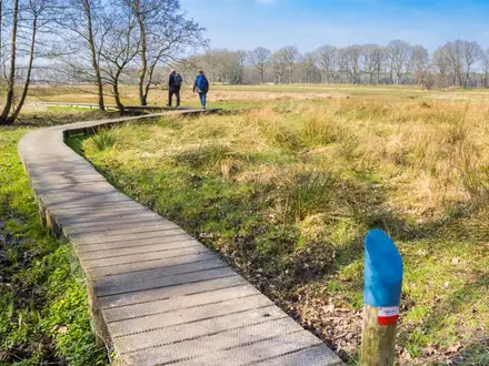
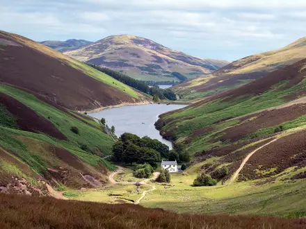
The Biesbosch National Park Trail is best understood as the waymarked Jantjesplaat circular walk: an approximately 16 km loop from Biesbosch MuseumEiland near Werkendam in the Netherlands. It is a flat easy-to-moderate day walk, taking about 4 to 5 hours, through one of north-west Europe’s last large freshwater tidal wetlands. Expect willow flood forests, reed marsh, polders, creeks and muddy natural paths. It suits walkers wanting a full-day nature route rather than a hut-to-hut or high-mileage thru-hike.
Route Overview
The loop starts and ends at Biesbosch MuseumEiland, Hilweg 2, Werkendam, where free parking is available. From the museum area the marked circular route heads through the Brabantse Biesbosch, taking in Jantjesplaat nature reserve, Deeneplaat, willow flood forests, reed beds, creeks and sections beside the Nieuwe Merwede river before returning to the start. The route is circular, so there is no end-to-end transport problem, but it is not a single official long-distance trail name: the park has many marked walks from 2 km to about 21 km, plus the 169 km Biesboschpad. For other Dutch lowland walking, compare the Groene Hart Pad or the Dutch Coastal Path.
How the Biesbosch Wetland Was Formed
The Biesbosch landscape was shaped by flood, silt and human water management. The St Elizabeth’s flood of 1421 submerged roughly 300 km2 of reclaimed polder land, after which centuries of silting and reclamation created the wetland pattern of creeks, islands and polders. The Haringvliet dam, completed in 1970, reduced the area’s tidal range by cutting the direct link to the sea. In 2011–2015 the Noordwaard polder was deliberately returned to water for flood safety, leaving the MuseumEiland on an island. The national park was designated in 1994.
Notable highlights
- Biesbosch MuseumEiland: The route’s hub is a grass-roofed eco-museum that explains the tidal landscape. Its turf roof forms a short climb to a lookout before or after the walk.
- Jantjesplaat nature reserve: This is the core of the common circular walk, with wetland paths through willow flood forest, reed beds and low islands.
- Deeneplaat: Another key reserve on the loop, preserving grienden — coppiced willow flood forest managed in a traditional wetland style.
- Beavers and birdlife: European beavers were reintroduced here in 1988, and walkers can often spot gnawed willows or lodges. Herons, egrets, kingfishers and waterfowl are also typical of the marshes and creeks.
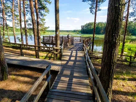
- Nieuwe Merwede and tidal creeks: The broad river and the network of killen and kreken define the walk’s waterscape, with observation points and lookout towers along the way.
Challenges to expect
The difficulty is not elevation: total climb is negligible, around 15 m. The challenge is the length, wet ground and uneven natural paths. Parts of the depoldered areas can flood at high water, and muddy stretches are common, so waterproof footwear is sensible. Navigation is generally straightforward on marked routes, but the park has multiple variants, so check you are following the Jantjesplaat loop. For another Dutch national park walk, see the De Meinweg National Park Trail.
HikeList Score
Biesbosch National Park Trail scored 74/100 on HikeList's trail-quality metrics.
See score breakdownHide breakdown
- Ideal length 55
- Balanced challenge 90
- Scenery & wildness 58
- Varied terrain 100
- Accommodation 66
- Food & support 88
- Path quality 81
- Season flexibility 89
Computed from length, challenge, scenery & wildness, terrain variety, accommodation, food & support, path quality and season flexibility.
Show more data Show less
- Freshwater Tidal Wetland
- Willow Forest
- Reed Marsh
- Polders
- Creeks
- Paved
- Unpaved Nature Paths
- Forest Trails
- Dikes
- Footbridges
- Hotels
- Campsites
- Family Friendly
- Pet Friendly
- Restrooms
- Water Sources
- Campsites
- Picnic Areas